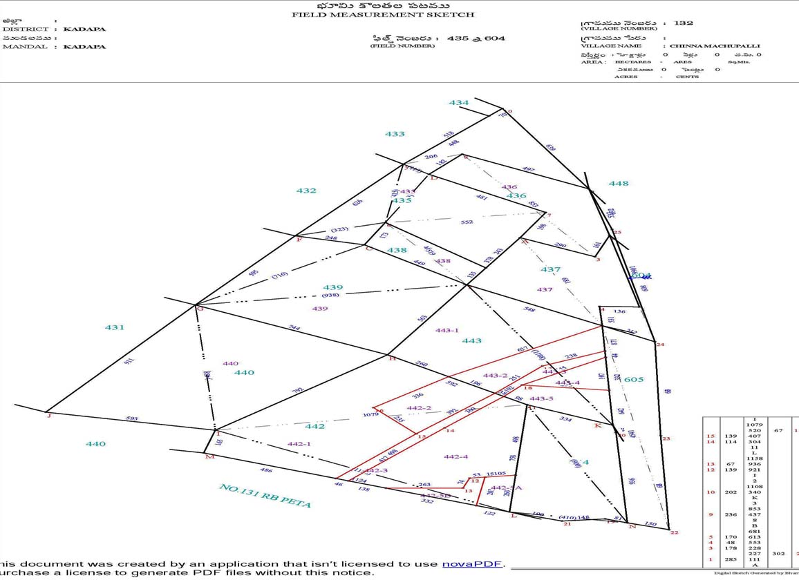
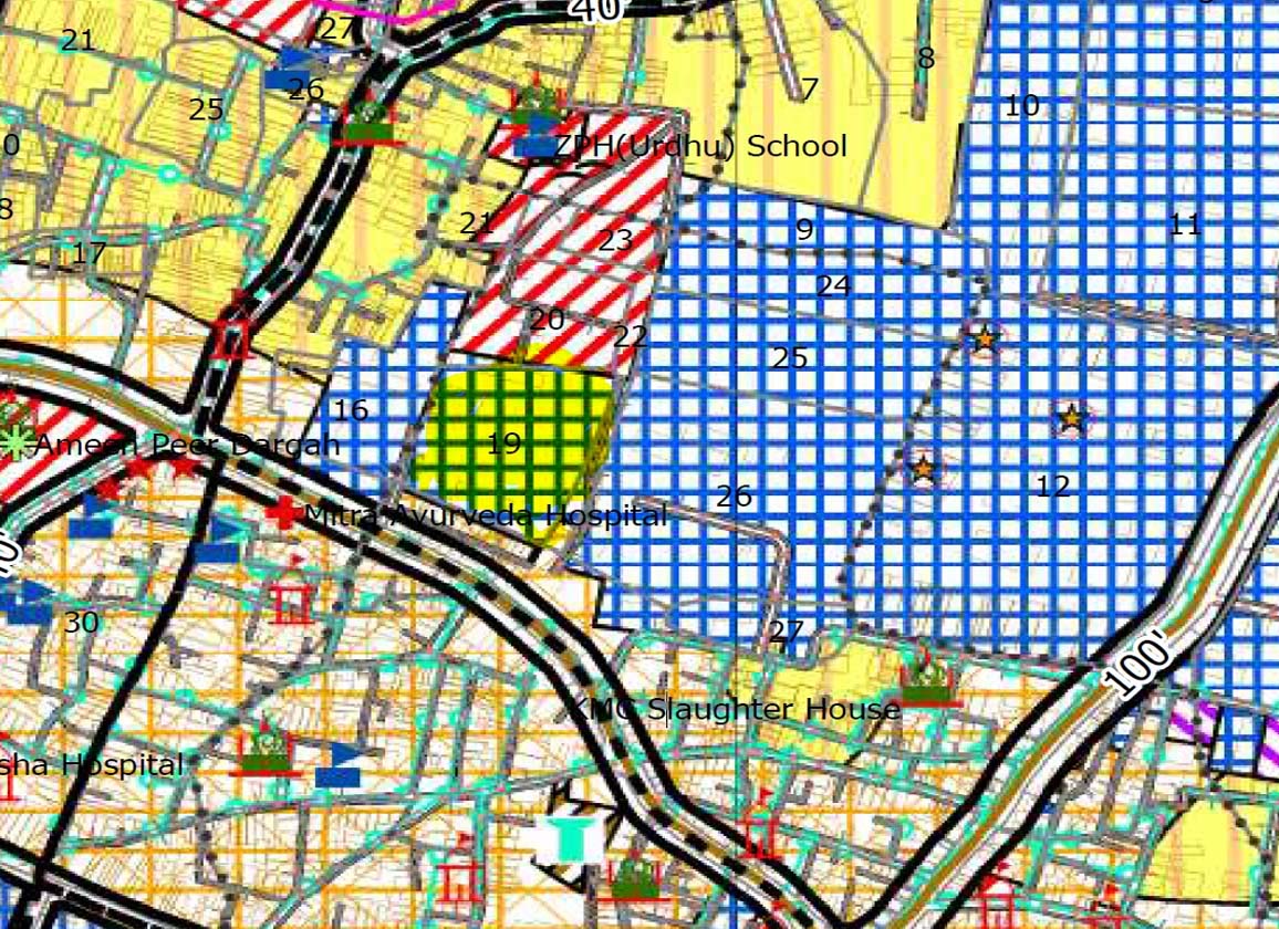
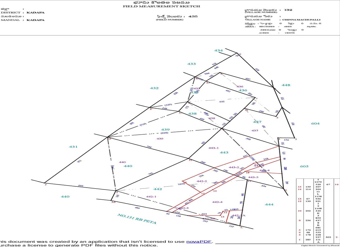
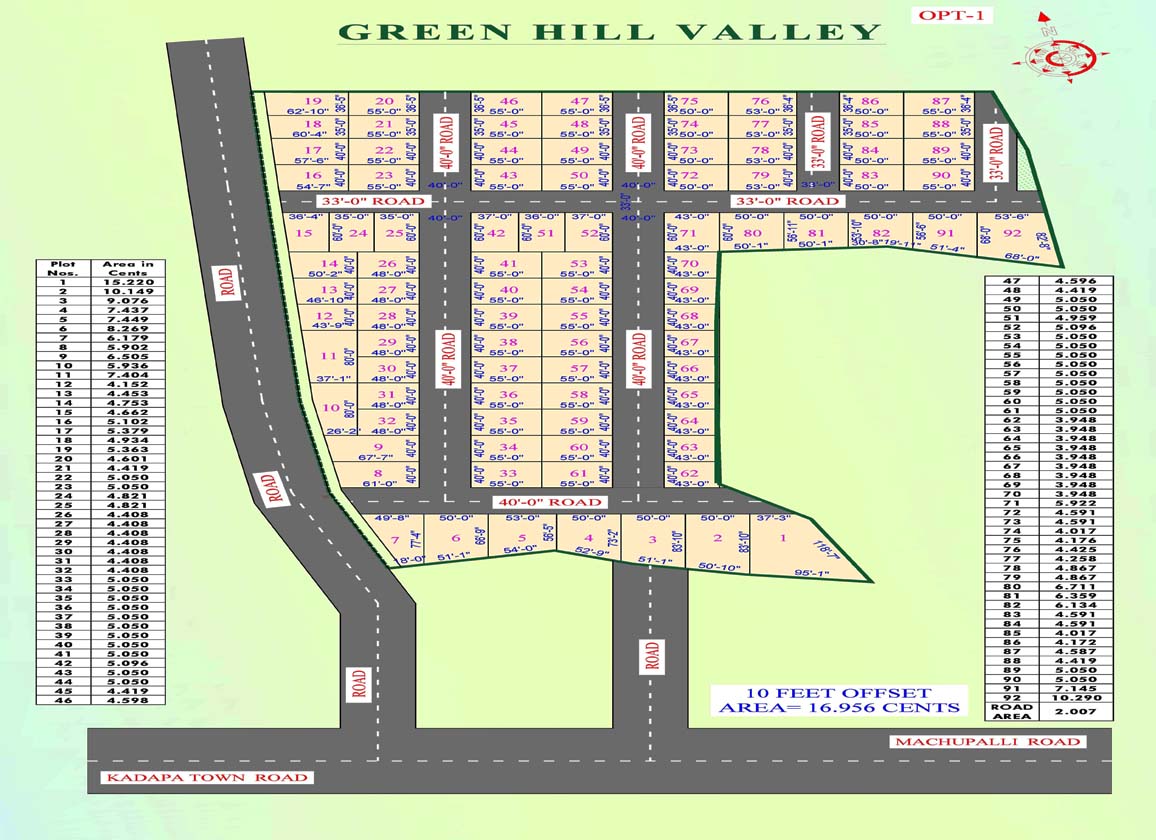
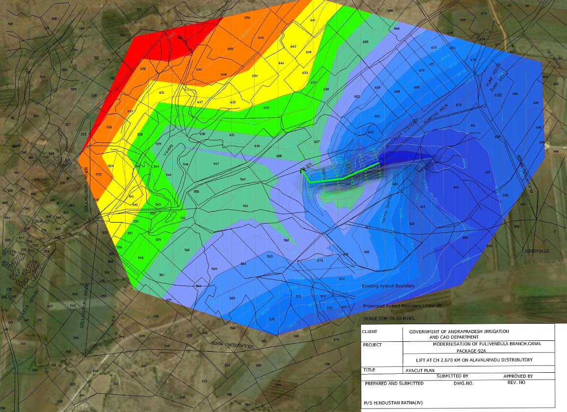
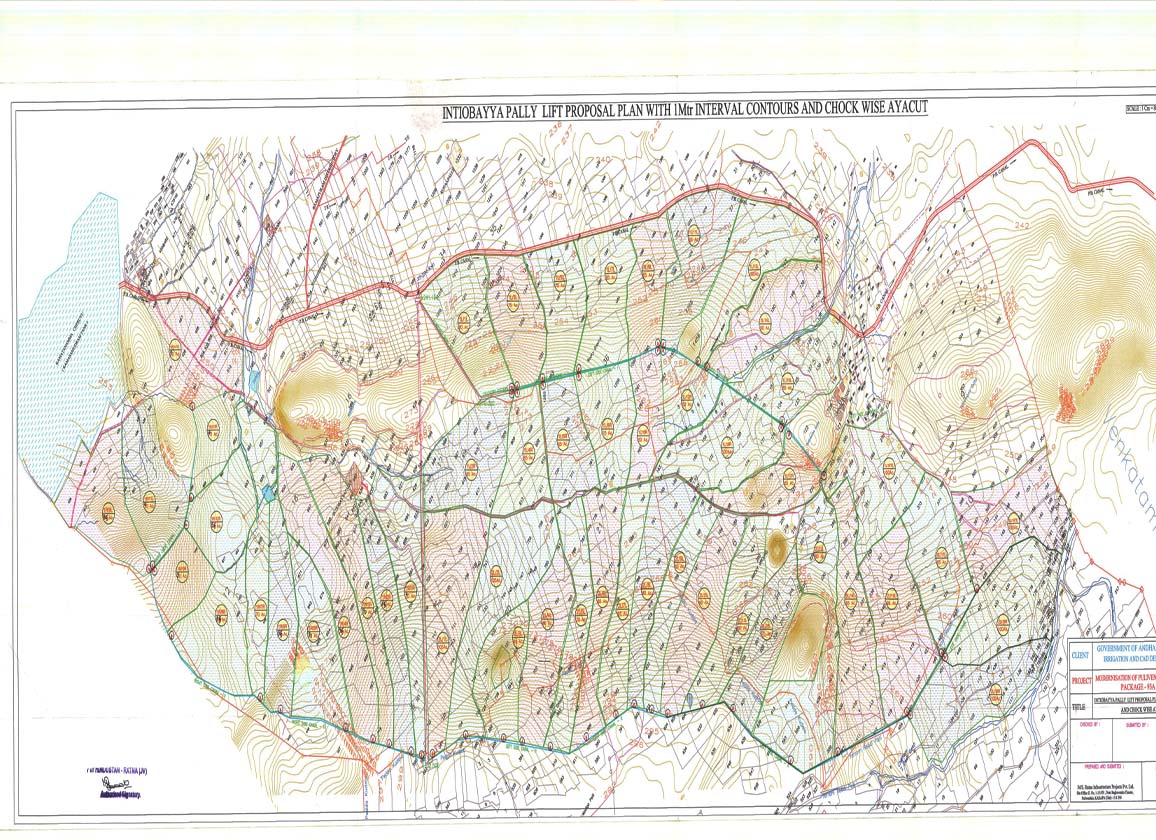
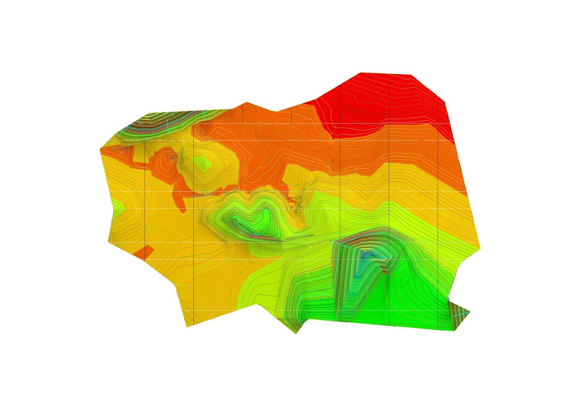
GIS Mapping Software uses spatial data to create maps and 3D models out of layers of visual information, revealing patterns and relationships in the GIS data. Many industries and government data analytics agencies use GIS to better communicate complex information and solve problems associated with geographic locations.
- Designing of Maps
- Digitization of Maps & Data
- Digital Terrain Maps & Processing Data
- Geo Base Maps (UTM WGS 1984)